Look What LICA is Up To!
Use this interactive map to explore LICA’s watershed, airshed, and outreach programs. Click the symbols on the map to learn more!
ANNUAL REPORTS
Watershed Posters
Beaver Lake Watershed 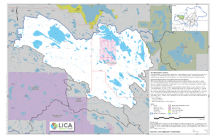
Beaver River Watershed 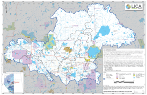
Bonnyville Watershed 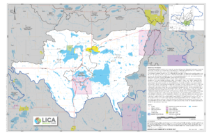
Cold Lake Watershed 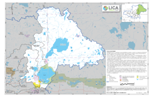
Crane Lake Watershed 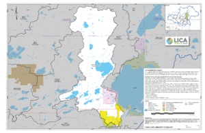
Long Lake Watershed 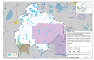
Moose Lake Watershed 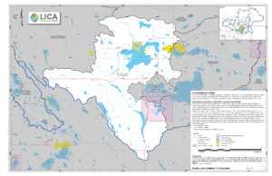
Muriel Lake Watershed 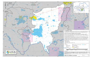

Library
Air
| About the Air Quality Health Index | View Document |
| How Does Wildfire Smoke Affect My Health? | Watch Video |
| What is an Airshed? | Watch Video |
| CASA Air Emission Report – Recommendations to Reduce Non-Point Source Air Emission in Alberta | View Document |
| Alberta Airsheds 2022 Annual Air Quality Report | View Document |
Water
| 2019 Alberta Environment and Parks Groundwater Presentation | View Document |
| Beaver River Watershed Indices of Aquatic Ecosystems | View Document |
| 2019 Water Quality Report Lac La Biche Lake West Basin | View Document |
| 2019 Water Quality Report Lac La Biche Lake East Basin | View Document |
| 2019 Fork Lake Water Quality Report | View Document |
| 2019 Elinor Lake Water Quality Report | View Document |
| 2019 Beaver Lake Water Quality Report | View Document |
| Drivers of Lake Water Quality in the Beaver River Watershed | View Document |
| Fish-based Index of Biological Integrity for Assessing Ecological Conditions in the Beaver River Watershed | View Document |
| Moose Lake Nutrient Export Study 2015 | View Document |
| Moose Lake Watershed Management Plan | View Document |
| Riparian Health Summary Final Report – Moose Lake Tributaries Project Area – Revisit | View Document |
| State of the Beaver River Watershed Report 2013 | View Document |
| WPAC Compendium | View Document |
| 2012 Aerial Riparian Survey User Guide | View Document |
| 2012 Beaver River Watershed Ariel Riparian Survey | View Document |
| 2022 Beaver Lake Water Quality Report | View Document |
| 2022 Elinor Lake Water Quality Report | View Document |
| 2022 Fork Lake Water Quality Report | View Document |
| Municipal Shoreline and Riparian Condition Assessment Report Card- County of St. Paul | View Document |
| Municipal Shoreline and Riparian Condition Assessment Report Card- MD of Bonnyville | View Document |
| Municipal Shoreline and Riparian Condition Assessment Report Card- Smoky Lake County | View Document |
| Municipal Shoreline and Riparian Condition Assessment Report Card- Thorhild County | View Document |
Long Term Soil Acidification Monitoring
| LICA Long-Term Soil Acidification Monitoring – Synthesis of Three Sampling Events – 2010 To 2020 | View Document |
| Cold Lake Site – 2021 | View Document |
| Tucker Lake Site – 2020 | View Document |
| Whitney Lake Site – 2019 | View Document |
| Moose Lake Site – 2018 | View Document |
| Tucker Lake Site – 2016 | View Document |
| Whitney Lake Site – 2015 | View Document |
| Moose Lake Site – 2014 | View Document |
| Tucker Lake Site Establishment – 2012 | View Document |
| Whitney Lake Site Establishment – 2011 | View Document |
| Moose Lake Site Establishment – 2010 | View Document |
| Exploratory Study of Potential Acidification Impact on Soils and Surface Water within the LICA Area | View Document |
Alberta Lake Management Society (ALMS) Reports
| LakeWatch 2023 | View Document |
| LakeWatch 2022 | View Document |
| LakeWatch 2021 | View Document |
| LakeWatch 2020 | View Document |
| LakeWatch 2019 | View Document |
| LakeWatch 2018 | View Document |
| LakeWatch 2017 | View Document |
| LakeWatch 2016 | View Document |
| LakeWatch 2015 | View Document |
LICA Initiated CreekWatch Reports
| Muriel Creek 2021 | View Document |
| CreekWatch 2022 | View Document |
| CreekWatch Buffalo Lake Metis Settlement 2023 | View Document |
| CreekWatch Kikino Metis Settlement 2023 | View Document |
Muriel Lake Winter Dissolved Oxygen Reports
| Winter 2021 | View Document |
| Winter 2022 | View Document |
Jessie Lake Restoration Project Riparian Health Summary Reports
| NE-12-061-06 W4M | View Document |
| SW-08-061-05 W4M | View Document |
Field Reports
| Summer 2022 | View Document |
Links
Water Stewardship Groups in the Basin: Moose Lake Watershed Society Crane Lake Advisory and Stewardship Society Muriel Lake Basin Management Society Skeleton Lake Stewardship Association Water for Life Partners: Water For Life –Alberta Environment Alberta Water Council (AWC) Alberta WPACs Other WPACS: Athabasca Watershed Council Battle River Watershed Alliance Bow River Basin Council Lesser Slave Watershed Council Mighty Peace Watershed Alliance Milk River Watershed Council North Saskatchewan Watershed Alliance Oldman Watershed Council Red Deer River Watershed Alliance South East Alberta Watershed Alliance National Water Organizations: Ducks Unlimited Canada (DUC) International Association of Hydrogeologists – Canadian National Chapter Living by Water Project Safe Drinking Water Foundation Canadian Water Resources Association Caring for our Watersheds RiverWatch(CreekWatch) – Provincial Water Quality Data The LICA region is located on and benefits from the traditional lands of the Denesųłiné, Nehiyaw (Cree) and the heart of the Métis Homeland: Cold Lake First Nations Kehewin Cree Nation Whitefish First Nations Beaver Lake Cree Nation Buffalo Lake Métis Settlement Kikino Métis Settlement Elizabeth Métis Settlement Saddle Lake Cree Nation Fishing Lake Métis Settlement Frog Lake Cree Nation Metis Nation Region 1 Metis Nation Region 2
Alberta Airshed Organizations: Alberta Airsheds Council Alberta Capital Airshed Calgary Regional Airshed Zone Fort Air Partnership Parkland Airshed Management Zone Palliser Airshed Society Peace Airshed Zone Association Peace River Area Monitoring Program Wood Buffalo Environmental Association West Central Airshed Society Alberta Environmental Organizations: ALUS Riparian Web Portal Alberta Biodiversity Monitoring Institute Alberta Conservation Association (ACA) Federation of Alberta Naturalists Alberta Environmental Network Alberta Lake Management Society (ALMS) Alberta Native Plant Council Cows and Fish Alberta Stewardship Network Alberta Water Portal Alberta Wilderness Association Cumulative Environmental Management Association Ducks Unlimited Canada – Alberta (DUC) Lakeland Agricultural Research Association (LARA) Municipalities in the LICA Region: M.D. of Bonnyville Lac La Biche County Town of Bonnyville County of St. Paul City of Cold Lake Smoky Lake County Thorhild County Athabasca County Vermilion River County County of Two Hills Village of Glendon Town of Elk Point Town of St. Paul